Please see the following link for available GIS, .AI, .3DM, .DWG etc files. https://cityofwater.wordpress.com/summary

In Peru, Kenya and India, NGOs are helping communities overcome water scarcity using wisdom from the past
Please see the following link for available GIS, .AI, .3DM, .DWG etc files. https://cityofwater.wordpress.com/summary
East-West Center 2016 New Generation Seminar
Now Accepting Applications
For full information about the program and how to apply please visit: http://www.eastwestcenter.org/seminars-and-journalism-fellowships/policy-dialogue/new-generEast-West Center New Generation Seminar 2016
EWC Contact: Ann Hartman, hartmana@eastwestcenter.org; 808-944-7619
Announcement
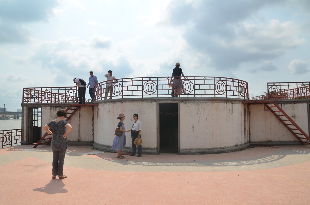
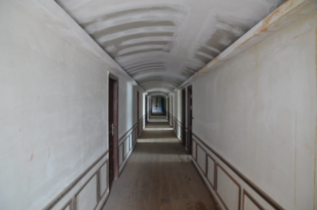
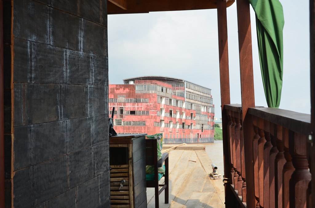
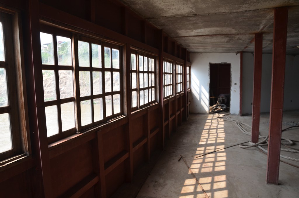
Cambodian Modern exhibition overview DRAFT 4.14.16
26th NGS Background Summaryation-seminar
Dates: September 18-October 1, 2016
Theme: Cultural Heritage and Identity in a Globalizing, Urbanizing World
Destinations: Honolulu, Hawaii; Phnom Penh, Cambodia; and Yangon, Myanmar
Application Deadline: Monday, June 13
Program: Now in its 26th year, the New Generation Seminar is an intensive two-week study, dialogue and travel program that provides the next generation of Asia Pacific and American leaders an opportunity to strengthen their understanding of key Asia-Pacific developments, discuss policy options for common challenges, build an international network, and become leaders with a more international perspective. The first week of the program is held in Hawaii and focuses on key regional policy issues such as international relations, security, economics, population, health and environment. The second week involves field travel to either the United States or Asia Pacific for exploration of the program theme. Please see write up below for details about this year’s theme.
Who can apply: The New Generation Seminar seeks to engage young leaders aged 25-40, from Asia Pacific and the United States who are in a position to influence policy, shape public opinion and lead action. The strongest candidates for the program will be elected officials and other political, business, law and community leaders or communicators with broad-based policy knowledge and influence and/or demonstrated leadership in their countries and communities. Social and business entrepreneurs also make strong candidates.
Funding: Through East-West Center and private funding, up to 14 selected candidates will be offered full or partial funding. Full funding would cover air and ground travel as well as modest meals, lodging and program-related expenses during the two-week program. Participants will be responsible for their own visa fees and visa related expenses, travel/health insurance and personal incidentals. Cost sharing by applicants is strongly encouraged and will be an important consideration for the Selection Committee.
The East-West Center is an internationally recognized independent nonprofit organization established by the US Congress in 1960 to promote better relations and understanding among the people and nations of the United States, Asia and the Pacific through cooperative study, research and dialogue. For more than half a century, the East-West Center has been training global leaders, informing policymakers, advancing education and promoting international understanding in the Asia Pacific region around critical issues of regional and global importance.
26th NGS Theme: Cultural Heritage and Identity in a Globalizing, Urbanizing World
Over the past 20 years, the increasing pressures of intensive urbanization, globalization and a trend toward modernization have been threatening cultural and architectural heritage around the world. In many urban areas, the legacy of the past is rapidly disappearing. In October 2016, global leaders will meet at the UN international Conference on Housing and Sustainable Development (Habitat III) to create a new urban agenda for the world, and, for the first time, issues of cultural heritage and its importance to cities will be part of the agenda. There is growing recognition that cultural heritage and architecture can be a key resource and asset for building sustainable, livable, and dynamic cities, with evidence that conserving unique heritage can bring significant economic value through tourism and creative industries. Beyond that, it also plays an important role in fostering national and local pride and a sense of identity for its residents. In communities across the world, but especially in rapidly modernizing and globalizing developing countries, government leaders and officials are expressing a strong interest in placing culture at the core of development strategies, to consider what is important to keep for future generations before it is lost forever. But doing this is not easy as leaders must also meet the enormous pressures to provide efficient infrastructure, housing, sanitation, commercial development and jobs for their communities.
The 2016 NGS participants will explore the role of cultural heritage in economic development, urban planning, tourism, and in preserving and promoting a sense of local and national identity through meetings and visits with leaders and policymakers, private sector representatives, civil society organizations, academic experts and practitioners in Honolulu, Phnom Penh, and Yangon. Honolulu will provide an example of a US city struggling to preserve its local identity and culture in its tourism development and as it upgrades its aging infrastructure and revitalizes its urban core. Phnom Penh and Yangon represent common challenges in developing nations of rapid urbanization, a need for development and threats to preserving their urban culture, including both colonial and post-colonial architectural heritage. Both are at a critical juncture in their development strategies. Phnom Penh is on a rapid growth trajectory after many years of war and internal conflict; Yangon is emerging from decades of economic and social isolation with a new democratically elected government. All three cities must manage break-neck growth, provide infrastructure and services to growing populations, attract outside investment and industry, and manage burgeoning tourism, while trying to figure out how to maintain and preserve that which represents and can foster their sense of national identity, culture and place.

Please consider donating: https://www.indiegogo.com/projects/a-floating-art-centre-for-phnom-penh#/
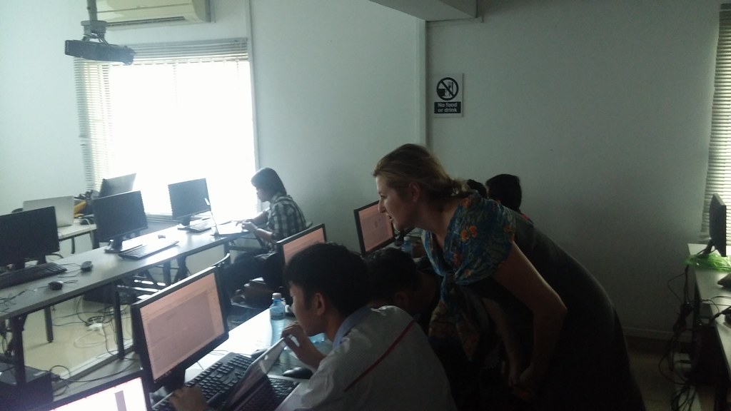
Thank you to Alex and Dana for the tour. An amazing space with fantastic potential.
More photos: https://www.flickr.com/photos/ny_sed/albums/72157660867219173

Thank you: to Limkokwing for hosting me, to Heng Pisey for organizing,and to Nick Senske for the long distance support from Iowa!
Nick Senske, Assistant Professor of Architecture, Iowa State, YouTube Channel https://www.youtube.com/user/nsenske
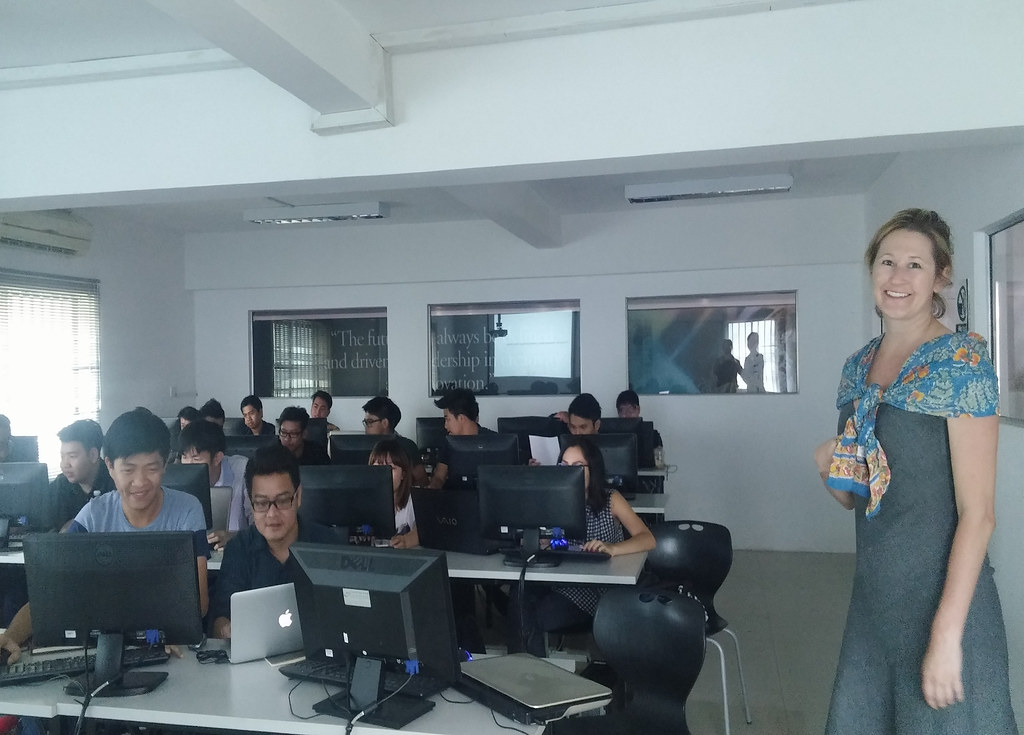
Resources from the workshop:
Rhino is a surface modeler that uses NURBS, Non-Uniform Rational B-Splines, are mathematical representations of 3-D geometry that can accurately describe any shape from a simple 2-D line, circle, arc, or curve to the most complex 3-D organic free-form surface or solid.
Free 90-day trial of Rhino: www.rhino3d.com/download/rhino/5/latest
Free Grasshopper: www.grasshopper3d.com/page/download-1
http://www.rhino3d.com/nurbs.htm
http://www.rhino3d.com/
http://www.rhino3d.com/support.htm
Labs and Plug-Ins
http://www.rhino3d.com/download.htm
http://www.rhino3d.com/resources/
http://www.food4rhino.com/?ufh
Command list
http://docs.mcneel.com/rhino/5/help/en-us/commandlist/command_list.htm
Basic Rhino Tutorials
https://www.rhino3d.com/tutorials
Everything Rhino Related
http://v5.rhino3d.com/
Tons of video tutorials (Rhino TV)
http://www.rhino3d.tv/
Digital Fabrication (Rhino FabStudio)
http://www.rhinofabstudio.com/
Jewelry & Fashion & Furniture Design (GJD3D)
http://www.gjd3d.com/
Basics
http://digitaltoolbox.info/rhinoceros-basic/
Videos to watch:
Intro to GH interface / parametrics:
https://www.youtube.com/watch?v=A9OdZKsSIq8
Variables and relationships:
https://www.youtube.com/watch?v=WJ4AmEBX_MU
Repetition and loops:
www.youtube.com/watch?v=-CtY_SV5Sbc
Distribution and logic:
https://www.youtube.com/watch?v=r-eQ4wjQRK0


https://www.generosity.com/fundraisers/javaarts-fire-relief-fund–2
Just over a month ago a terrible fire burned down the JavaArts office and storeroom in Phnom Penh, Cambodia. The homes of 9 families were destroyed, leaving many people homeless. Fortunately no one was hurt.
http://www.phnompenhpost.com/national/night-time-blaze-behind-cafe-guts-homes-and-destroys-art
We are devastated, however, by the loss of 150 artworks by eight artists. Many of whom JavaArts has been working with for many years. Those works were moved there just that day from our gallery space which we were kicked out of when the house owner sold it a few weeks before.
The work of eight artists: Anida Yoeu Ali, Chath PierSath, Genevieve Marot, Neak Sophal, Nicolas C Grey, Oeur Sokuntevy, Qudy Xu-Min and William Graef are valued at $20,000 and accounts for about 10% of the available works on the art market in Cambodia.
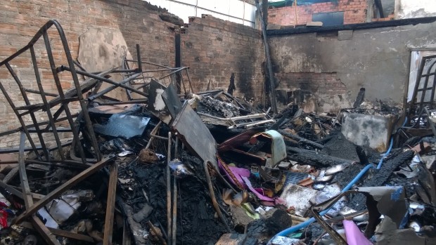
Our initial shock turned into grief, and grief turned into thinking about real and practical things. Each of these artists depends on the sales of their artworks to live, to maintain visibility and to continue making art – it is an important part of who they are.
For 15 years, JavaArts has provided support, space for exhibitions, and artwork storage for artists in Phnom Penh. It is an important and needed platform for the incubation and production of contemporary art in Cambodia. While many of the artists affected by the fire will continue their work, Cambodia’s art history suffered because those 150 artworks are gone forever. This terrible accident just shows how fragile the Cambodian art scene really is.
Without insurance or other means to cover the artists’ loss of income, we are turning to the community for support.
$20,000 – This amount of the money raised will go to the artists to cover their individual losses. The 150 artworks are in fact valued much higher, but this will cover the loss of income that they would have received if the works were sold.
Over the goal – We also see this as an opportunity to reinvent and demonstrate resilience. Any money raised over $20,000 will be put in a fund for an artist-led project to be developed by the eight artists affected by the fire.
JavaArts continues to support artists in Cambodia through its exhibition platform and is committed to nurturing emerging talents now and in the foreseeable future.
Without your support, none of this would be possible. Thank you!
In Peru, Kenya and India, NGOs are helping communities overcome water scarcity using wisdom from the past
Wednesday 19 August 2015 08.24 EDTLast modified on Sunday 23 August 201502.20 EDT
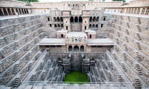
Across large swaths of the Thar desert in western India, traditional techniques for harvesting the little amount of rain that falls has helped people survive the powerful effects of the sun for centuries.
The most beautiful of these are step wells – known as baolis in Hindi – large, stone structures built to provide water for drinking and agriculture. Baolis have existed for at least 1,000 years and were constructed in towns and alongside serais (travellers’ inns), across the desert and into Delhi.
Baolis exist in all shapes and sizes and are essentially reservoirs built into the earth. Groundwater is pulled up from a circular well at the bottom and rainwater is collected from above. A set of steps – on one or more sides of the structure – lead down to the water level, which fluctuates depending on the amount of rain. More recently, electric pumps have been installed in many baolis to help retrieve the water.
“Step wells are etched into people’s collective memory so deeply, they are now part of their DNA, passed on from one generation to another,” says Farhad Contractor of the Sambhaav Trust, an ecological conservation group.
Today, many baolis have fallen prey to rapid urbanisation and neglect. In Delhi only around 15 survive but local groups are fighting to protect and preserve them. While 700mm of rain falls on Delhi every year, half of the city has been declared a dark zone – where the groundwater level has depleted so much that the rate of recharge is less than the rate of withdrawal – by the groundwater authority. Rainwater harvesting, therefore, is key to a secure water supply for India’s second-biggest city.
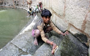
One such baoli restored by the Aga Khan Trust for Culture(AKTC) was built in the 14th century in Hazrat Nizamuddin Basti, a medieval village in Delhi named after Sufi saint, Hazrat Nizamuddin Auliya. In 2008, parts of the baoli walls collapsed due to sewage water seeping into the structure and the local residents using it as a rubbish dump. The pool was drained and the rubbish, garbage and sludge that had accumulated over the past 700 years was removed to reach the foundation of the baoli some 80 feet below ground level. While the water in the baoli is still not potable, it can be used for cleaning and agriculture.
Experts say the baoli model can be replicated anywhere in the world with similar climatic conditions and physiological features. Contractor has been invited to Morocco where he is working on a project to build baolis and smaller wells, known as beris in Hindi.
But large baolis need large catchment areas, and in Delhi space is an issue. While the majority of the physical structures of baolis are protected – some by being sited inside historic monuments – urban development in Delhi has had a greater impact on their water levels; storm drains divert rain away from baoli catchment areas.
Diwan Singh, an activist with non-profit Natural Heritage First, says that even though many baolisin Delhi are surrounded by buildings, the wells can still be recharged. “Catchment area management is the key. In the small areas of land between the baolis and buildings, rainwater harvesting pits could be built to divert rainwater away from the storm drains,” he says. “Once in the pit, water will percolate through the soil and recharge the nearby baoli, allowing modern development and ancient structures to co-exist side by side.”
Nivedita Khandekar
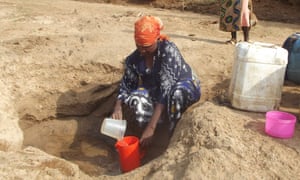
Makueni County – just over 100 miles south of Nairobi – has one of the most inhospitable environments in the country.
The region’s sandy loam soil supports little else besides the thorny, stunted shrubs that stretch for miles, interspersed only by gigantic baobab trees or some species of the hardy acacia. The only food crops cultivated here are sorghum, cassava and pigeon peas – drought-tolerant crops. With an average annual rainfall of just 600mm, meaningful agriculture is nearly impossible.
Water access is a big problem. In Kenya, 63% of the population use an improved source of drinking water and 46% live below the poverty line. Women and girls in sub-Saharan Africa spend up to four hours a day fetching water, according to the One campaign.
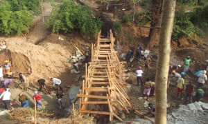
But things are changing for the better, thanks to an ancient water harvesting technique being used in the dry regions. Sand dams, which were invented by the Romans in 400BC, have become an important source of water for domestic and agricultural needs.
Sand dams are constructed by building a concrete barrier or wall across a seasonal river with a firm bedrock. As the river flows, sand in the water is deposited behind the wall. Over time, layers of sand build into a reservoir for water, which remains stored in the sand once the river level drops. Evaporation is virtually impossible below a metre of sand – no matter how intense the sun – and the water is clean and safe for immediate drinking as the sand acts like a filter.
The Africa Sand Dam Foundation (ASDF) has been facilitating the construction of the dams alongside Excellent Development (ED), a UK-based NGO that has enabled the construction of 838 sand dams in rural dry lands across eight countries. The work of ED has improved access to clean water for more than 800,000 people, according to Jonny McKay, the NGO’s communications manager.
Not only have the sand dams improved water security for local communities. Villagers are also coming together to form self-help groups to construct the dams with assistance from the NGOs, and to initiate agro-based economic schemes.
“We are able to practise agribusiness now that we have water available for irrigation,” says Elizabeth Ndungune, the chairwoman of the Star Thange self-help women’s group in Ulilinzi. Using water from the sand dam built on the nearby River Thange, the group can now grow kale, tomatoes, beans and other crops. They sell whatever they harvest and pool the proceeds, which help families pay for school fees.
While sand dams are a cheap and simple solution to some complex problems, they can fail if they are not applied in a way that meets the users’ needs. “The biggest challenge is ensuring that the technology is applied to specific local conditions and people’s needs, rather than simply being replicated from one place and situation to another,” says McKay.
But the initiative is gaining momentum and expanding not only to other parts of the country, but to Tanzania, Chad, Zimbabwe, Mozambique and even to India.
Geoffrey Kamadi
On the hardscrabble, treeless highland plain that joins Peru with Bolivia, farmers have eked out an existence for thousands of years amid bitter winters and the harsh sun, at 4,000 metres above sea level and higher.
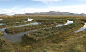
As scientists predict climate change will make the Altiplano’s weather even more inclement and unpredictable, today’s farmers are reviving an ancestral system of cultivation and irrigation using what looks like an intricate piece of land sculpture.
Resembling an ornate garden maze from above, suqakollos – or waru-warus – are a patterned system of raised cropland and water-filled trenches.
Alipio Canahua, an agronomist working with the Food and Agriculture Organisation (FAO), says that the ancient agricultural system, which could date back 3,000 years, actually creates its own microclimate.
“It captures water when there are droughts and drains away water when there’s too much rain, meaning that it irrigates the crops all year round,” he says. “When it comes to temperature, we’ve measured a rise of three degrees centigrade in the immediate environment around it – this can save a significant percentage of the crops from being killed in frosts.”
A suqakollo can also be a small oasis in the scorching daytime sun, which yellows even the coarse highland grass, known as ichu – the main fodder for the alpacas and llamas herded by the local Aymara people.
Canahua has been leading the resurgence of this ancient farming system with local communities, restoring old suqakollos and building new ones.
Sonia Ticona, a local indigenous Aymara leader who has been working with Canahua, says that in her village, the women work harder than the men to dig the trenches which are filled with water.
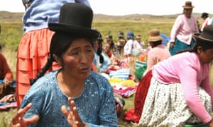
“Our great-great-grandfathers used the suqakollo system then at some point, and we don’t know why, they stopped. Now we are restarting it and bringing it up to date – men and women working together.”
Potatoes have been sown this season – next year it will be quinoa – in a carefully planned crop rotation, explains Canahua. While the yields are smaller than cultivating in larger fields, beating the plummeting winter temperatures, which can reach -20C, can prevent devastating crop losses.
The suqakollos project is one of several globally important agricultural heritage systems (GIAHS) funded by the Global Environment Facility (GEF), which is working with the regional governments of Cusco and Puno. Along with Peru’s agricultural ministry, the FAO is promoting family farming with the GIAHS methodology.
Canahua’s only frustration is that it’s not possible to make the suqakollos as big as Puno’s pre-hispanic people did. Archaeologists say that people have lived on the Altiplano – on the shores of the highest navigable lake, Lake Titicaca – for some 8,000 years, and traces of the ancient canals still mark the high plain. Roads and boundaries between communal lands, however, have limited the space available.
John Preissing, the FAO’s representative in Peru, says the pilot project has produced more than double the normal crop yields.
“We can’t isolate just the fact that we‘re using suqakollos but we can say that between the water management, the soil management and the fertiliser management, we are reaching double the harvest numbers.”
Figures for 2013-14 indicate that suqakollo’s crop yields for quinoa are 3.2 tonnes per hectare, more than double the average of 1.3 tonnes per hectare for the same crop grown on the plain.
Ancestral crops like quinoa, and its kiwicha and kaniwa varieties, could make this labour-intensive, complex farming system worthwhile; international demand for the superfoods has multiplied the price, bringing in extra income for these smallholder farmers.
Dan Collyns
Join our community of development professionals and humanitarians. Follow@GuardianGDP on Twitter, and have your say on issues around water in development using #H2Oideas.
New York Public Library Puts 20,000 Hi-Res Maps Online & Makes Them Free to Download and Use
The Lionel Pincus & Princess Firyal Map Division is very proud to announce the release of more than 20,000 cartographic works as high resolution downloads. We believe these maps have no known US copyright restrictions.* To the extent that some jurisdictions grant NYPL an additional copyright in the digital reproductions of these maps, NYPL is distributing these images under a Creative Commons CC0 1.0 Universal Public Domain Dedication. The maps can be viewed through the New York Public Library’sDigital Collections page, and downloaded (!), through the Map Warper.
What does this mean? Simply put, “it means you can have the maps, all of them if you want, for free, in high resolution.” Maps like that above, of New York’s Central Park, issued in 1863, ten years before Frederick Law Olmstead and Calvert Vaux completed their historic re-design.

A bevy of 3D-printed pseudo landmines.
PHNOM PENH, Cambodia — Inside a design laboratory in Phnom Penh, 3D printers run day and night to create safe imitations of some of the world’s deadliest weapons.
The plastic results sit harmlessly on tables and shelves next to their inert — but real — counterparts. There’s a grenade, an M42 cluster munition and a PMN2 landmine, one of the most common found in Cambodia.
“This is a booby trap,” said engineer John Wright, handling a different item about the size of a flashlight.
He describes a hypothetical scenario in which a book has been placed on top of the trap to lure a potential victim.
“What it would do is as they picked up the book, this would fire,” he said, taking his finger off a red plastic part, causing a loud snap.
Releasing pressure sends a firing pin down the length of the device, which would in theory be attached to a detonation cord, setting off “something really big, some explosives,” he said. “That would then go off.”
These 3D-printed fake bombs are changing the way demining is being taught around the world.
With $100,000 in seed funding from the State Department and a diverse cast of collaborators pitching in, the Golden West Humanitarian Foundation, a leading demining group with offices in the US and Cambodia, created what’s called the Advance Ordnance Training Materials kit at its design lab in Phnom Penh.
Wright is Golden West’s chief design engineer.
The AOTM comes in a large suitcase that carries 10 3D-printed devices. Each model contains different arming and firing mechanisms that technicians venturing into the field need to understand.
The idea is to teach the principles behind why something explodes. As such, while they look recognizable as different types of bombs, they are not exact replicas in shape and size. For one thing they are built to be bigger. The lab has designed several additional devices for the next phase of the project, like the PMN2 landmine, meant to be more of a piece-by-piece clone.
3D printing has been used to make replicas of landmines before, but Golden West says what separates their models from predecessors is intricacy and detail. In the finished product, the anatomy of different bombs is completely on display, like a car with the hood up. Deminers will learn like mechanics.
The project has its roots in 2012 when an MIT professor named J. Kim Vandiver was visiting one of his graduate students in Phnom Penh. The student was working with Golden West on a method for removing fuses from unexploded bombs. Vandiver met with the group’s Cambodia country manager, Allen Tan. Over coffee Vandiver asked Tan, who is also Golden West’s director of applied technology, about possibly teaming up on something with the Singapore University for Technology and Design.
“I asked him to think of projects that SUTD students might contribute to. In the course of the conversation, we came up with the idea to 3D print training aids,” Vandiver said by email, explaining that MIT and the school in Singapore have an ongoing partnership. “SUTD had great 3D printing capability to test out the idea and interested students.”
Tan, a former explosive ordnance disposal technician who served in Iraq and Afghanistan with the US Army, said that 3D printing solves multiple problems of teaching the trade. First of all, it’s faster and more productive than injection molding. Small changes in design can be made quickly and precisely.
It’s important to have flexibility with production because of the limited global supply of non-hazardous ordnance. Even with what there is, transportation is a headache.
“There’s these pieces of inert ordinance that sit in EOD classrooms. And when you go into a new country, you cannot bring inert ordnance, ship it trans-nationally, because it’s considered a weapons system still,” Tan said in an interview. “I can’t get it on an airplane, I can’t ship it via FedEx.”
Finally, there’s the advantage of the visual and tactile training aid.
“Most of our best guys who work for us here in Cambodia, they didn’t get to go to high school. It was Khmer Rouge time,” Tan said, referring to the radical communist movement that killed nearly 2 million people from 1975 to 1979. “You are talking about a workforce that isn’t used to learning from books, learning from powerpoints.”
“The reason that EOD technicians or operators, the reason that they need to understand how bombs work is that they can make good decisions on how to deal with a bomb when they find one,” he added.
By “bomb” Tan means to imply a broad group of ordnance including cluster munitions, mortars, rockets, artillery and landmines.
About two years passed between the first brainstorming coffee session and the first sale. The break came when Tan was presenting the kits to an annual demining conference held in South Africa last year. Representatives from the United Nations approached him afterward, pre-ordering 10 sets for use with peacekeeping missions in Africa.
Since then, orders have come from PeaceTrees Vietnam; the International Committee for the Red Cross in Switzerland, which is using the kit in Laos; and, amazingly, the American military’s School of Explosive Ordnance Disposal.
“Which is the school I went to in the US Army!” Tan said.
The kits cost $7,000 — with discounts for NGOs. The money is supposed to be reinvested into the project, making it self-sustainable and not reliant on donors.
In Cambodia itself, the Japan Mine Action Service (JMAS), a nonprofit that trains local deminers, purchased two sets.
Masato Kon, a 58-year-old explosive ordnance disposal expert with JMAS and a former longtime member of the Japan Self-Defense Forces, said in an email that it was “love at first [sight]” when he saw the kit.
“I was impressed with the design,” he said.
They don’t just help his Cambodian students learn, they help him teach.
“It is clearer and easier to explain the mechanism and structure of ordnance to beginners with tangible 3D models than photos or drawings,” he said
http://www.worldbank.org/en/region/sar/publication/urbanization-south-asia-cities
250 million more people are expected to live in cities in South Asia over the next 15 years. How can the region better manage its urbanization to create more livable and prosperous cities for all?
Summary
Urbanization provides South Asian countries with the potential to transform their economies to join the ranks of richer nations in both prosperity and livability, but a new World Bank report finds the region, while making strides, has struggled to make the most of the opportunity.
One big reason is that its urbanization has been messy and hidden, according to the report titled, “Leveraging Urbanization in South Asia: Managing Spatial Transformation for Prosperity and Livability.” Messy urbanization is reflected in the widespread existence of slums and sprawl. Sprawl, in turn, helps give rise to hidden urbanization, particularly on the peripheries of major cities, which is not captured by official statistics. Messy and hidden urbanization is symptomatic of the failure to adequately address congestion constraints that arise from the pressure of urban populations on infrastructure, basic services, land, housing, and the environment.
South Asia’s policymakers, the World Bank report says, face a choice: Continue on the same path or undertake difficult and appropriate reforms to improve the region’s trajectory of development. It won’t be easy but such actions are essential in making the region’s cities prosperous and livable.

Key Findings
Recommendations
